|
|
Ingleborough Yorkshire 3 Peaks
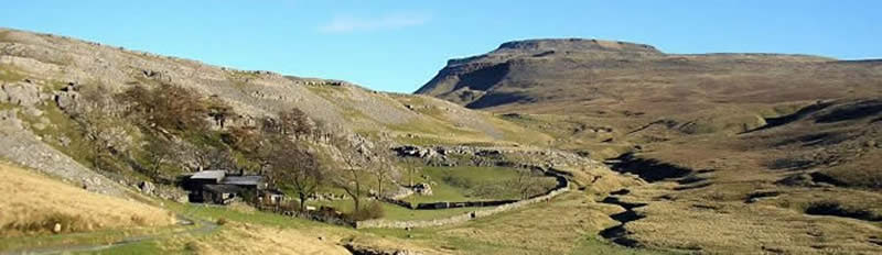
At 2,373 ft, Ingleborough, with its famous flat topped profile, is perhaps best known of the Yorkshire Dales' famous 'Three Peaks'.
The distinctive shape of Ingleborough is due to the local geology, a broad cap of millstone grit atop a broader plateau of carboniferous limestone.
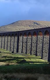
Streams running off the millstone grit meet limestone rock further down the slopes where they disappear underground, falling into deep potholes and caverns such as those at Gaping Gill on the moors above Clapham and Alum Pot near Selside in Ribblesdale.
After passing through complex underground cave systems these stream emerge at resurgence caves lower down, often at points of geological unconformity where the limestone lies on top of non permeable rock strata. |
|
 |
| |
|
|
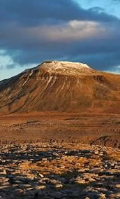
| Ingleborough has a cap of of millstone grit, followed by alternating layers of shales, limestones and sandstones of the yoredale beds which form the slopes.
The great scar limestone forms the main mass of Ingleborough, under which is the askrigg block - the uplifted land along the south craven fault.
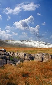
The surface limestone offers one of the best examples of upland limestone pavements in the uk, particularly around southerscales scars to the west.
Ingleborough hill-fort is an iron-age fortification constructed by the British north-western tribe, the Brigantes. It was probably built during the first century AD, when the area was under attack from the Romans who were determined to subject the area to their rule.
|
|
 |
| |
|
|
| Around the top of the summit, which is nearly a mile in circumference, the Brigantes built a 3000ft long stone rampart out of millstone grit, which has now collapsed.
There were three entrances in the northern, eastern and south-western sides of the wall. Within this enclosure are the remains of the foundations of a number of circular stone huts usually with south facing entrances.
When clear you can see the Irish Sea and the Isle of man to the west, and continuing in a clockwise direction Morecambe and Heysham, Baugh Fell and the Howgill Fells closer to home, and then Arnside and Cartmell Fells...
... and on to the Lake District with the Langdale Peaks, Helvellyn, Skiddaw and Scafell Pike. continuing we see Widdale Fells, Blea Moor and towards the Wensleydale hills.
|
|
 |
| |
|
|
| Further east are Fountains Fells, Pen-y-Ghent, and beyond that Great Whernside and Nidderdale, Buckden and Malham Moors. Southward are the hills and fells of Lancashire, including the Trough of Bowland and Pendle Hill.
This walk is likely to take you somewhere around 10 - 12 hours to complete, and is the distance of a full marathon - so making sure you are well supported is very important.
Although never too far from civilisation, these peaks should still be treated with respect as an accident can quickly become a major incident without proper preparation.
Our package includes instructors, drinks and refreshments and 2 nights accommodation allowing for a celebration meal in Horton in Ribblesdale on completion of the challenge.
|
|
 |
|
|