|
|
Scafell Lake District 3000 footers
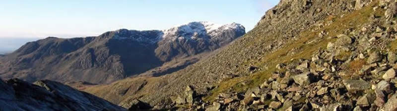
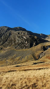
At a height of 964 m (3,162 feet) Scafell is the second highest mountain in England after Scafell Pike, from which it is separated by the pass of Mickledore.
It was once believed that Sca Fell was the largest mountain in this part of the Lake District - it is much more prominent in views from many directions than its higher neighbour - with the three apparently inferior peaks to the north (those now known as Scafell Pike, Ill Crag and Broad Crag) being known collectively as the "Pikes of Sca Fell".
Topography:
Sca Fell stands between Wasdale in the west and upper Eskdale to the east. The highest part of the fell is a ridge running south from Mickledore as far as Slight Side, which is counted as a separate fell by most guidebooks. |
|
 |
| |
|
|
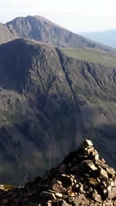
From the narrow ridge of Mickledore the northern face of Sca Fell rises precipitously, an unusually complete barrier to progress along a Lakeland ridge. At the top of the rise is Symond's Knott (3,146 ft), the northern top.
The wall of crags - Scafell Crag to the west and the East Butress above the Eskdale side of Mickledore have two main weaknesses. Running laterally across Scafell Crag is Lord's Rake, a scree filled chute with several intermediate cols. It has two upper entrances onto the saddle separating Symond's Knott from the main summit.
Normally passable as a scramble, it has recently suffered from rock falls and recent guidebooks do not consider it a viable route. The second breach in the crags is Broad Stand, a series of sloping steps which drop down from Symond's Knott almost to Mickledore. 'Almost' is used advisedly. The last section is a rock-climb. |
|
 |
| |
|
|
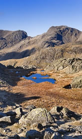
| The main summit stands a little to the south of the saddle, all around being a sea of stones. On the east are Cam Spout Crag and the fine high waterfall after which it is named.
Beyond Slight Side is a rough upland with many craggy tops and a number of tarns, before the southward descent finally ends in Lower Eskdale.
South West of Sca Fell, below the scarp of Great How, is Burnmoor Tarn, one of the largest in Lakeland. Around 40 ft deep it holds trout, perch and pike.
The tarn is prevented from following what would appear the natural line of drainage into Miterdale by morraines, and empties southward, reaching the Esk at Beckfoot. Near the southern shore stands Burnmoor Lodge, once a keeper's cottage and a dwelling two miles from the nearest road. |
|
 |
| |
|
|
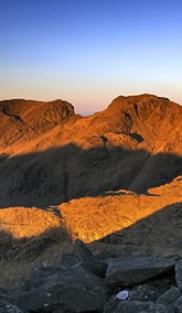
| Scafell Crag, the massive north buttress of Sca Fell, is one of England's largest cliffs and has many famous rock climbs including early routes which heralded the dawn of British Rock Climbing.
Ascent Route:
The 3000 Footers can be routed to suit the requirements of the individual group; and can start with the combined ascent of Scafell Pike and Sca Fell or alternatively culminate with the ascent of these two mighty peaks.
Although, the logistics of link transport especially by vehicle are more complex, completing this challenge event with the Sca Fells does provide the option to savour a bit of mountaineering history, finishing off with a 'Celebration Night' in Wasdale at the famous Wasdale Head Inn, synonymous with Lakeland mountaineering history since the birth of rock climbing. |
|
 |
| |
|
|
|
|