Latest News
Helvellyn summit
Mountain Adventures
Home Page Three Peaks Challenge Lake District 3000 Footers Yorkshire 3 Peaks Lake District Challenges Lake District Scrambles Glencoe Experience Black Cuillin Wilderness Mountains Preparation and Training Ascent Training Why do a Mountain Challenge? About Us

Helvellyn Lake District 3000 Footers

At a height of 950 metres (3,117 ft), Helvellyn is the third highest peak in England after Sca Fell.

Topography:

Helvellyn is the highest peak on the north-south ridge situated between Thirlmere valley to the west and Patterdale to the east. This ridge continues north over Helvellyn Lower Man, White Side, Raise, Stybarrow Dodd, Great Dodd and Clough Head and south leads to Nethermost Pike and Dollywagen Pike.

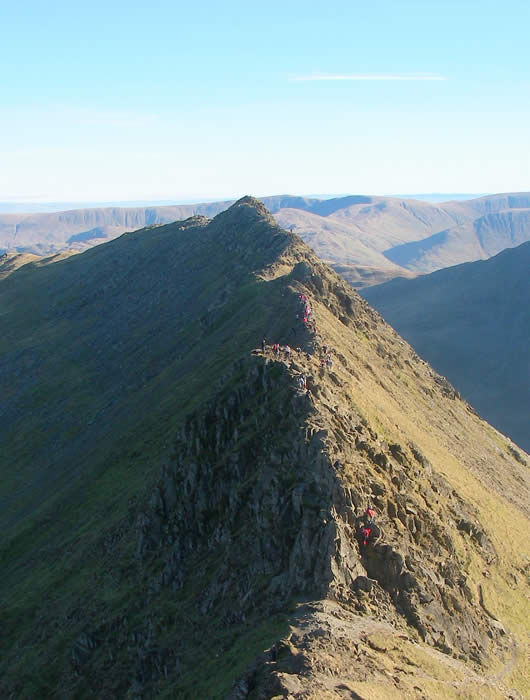
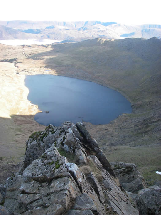
The eastern side of the fell is geographically the most dramatic. Two sharp aretes lead off the summit, Striding Edge and Swirral Edge, either side of Red Tarn. The knife-edged Striding Edge provides one of the best-known scrambles in Lakeland, while the Swirral Edge ridge leads to the conical summit of Catstye Cam.


  Walkers tackling Striding Edge
     

The summit of Helvellyn takes the form of a broad plateau about 500 metres long. The highest point is marked by a cairn and a cross-shaped dry stone shelter; to the north is an Ordnance Survey trig point, a little lower than the summit at 949 m (3,114 ft).

There is a subsidiary top, Helvellyn Lower Man, about a third of a mile to the north-west. Its summit is small compared to the plateau of Helvellyn and offers better views north-westwards, as the ground falls steeply away from it on this side.

Geologically, the summit area and Striding Edge are formed by the Deepdale formation of the Borrowdale Volcanic Group.This consists of volcaniclastic sandstone with some intercalcated tuff , pebbley sandstone breccia and lapilli-tuff. Underlying this is the Helvellyn formation of dacitic lapilli-tuff

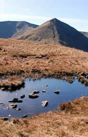
  Helvellyn and Catstye Cam
     

Helvellyn is strongly associated with the poet William Wordsworth, who used to climb the mountain regularly and also wrote about the mountain several times.

In particular he commemorated the death of Charles Gough, a tourist in the Lake District who set out to cross Striding Edge to reach the peak of Helvellyn. He perished there with his dog, who stood at his side for three months before his corpse was found. A plaque commemorating this event can be found close to the peak.

The somewhat flat summit made the first British mountain-top landing of a plane possible, when John Leeming and Bert Hinkler successfully landed and took off again, in 1926.

  Looking down to Red Tarn from Helvellyn summit
     

The western slopes bear witness to historic mining activity. Helvellyn (or Wythburn) mine operated from 1839 until 1880, when the land was acquired for the Thirlmere reservoir scheme. Four levels can be found along the course of Mines Gill, from where lead was extracted. Despite the sizeable workings the venture was never a commercial success

Ascent Route:

Our ascent/descent follows the most direct non-technical route to the summit from Swirls Car Park near Thirlmere which also affords the shortest distance to/from Skiddaw or Scafell Pike with the minimum amount of link transport and mileage on foot.

Alternatively, over a 2 day challenge with less time pressure we can also offer the more scenic and challenging route to the summit from the east ascending via Striding Edge and descending by Swirral Edge starting/finishing at Glenridding.

  Helvellyn summit panorama
© Copyright Activus Outdoors

Tel: (44) 17687 75337 Skype: Activus Outdoors: Skype Status

Looking for a different kind of adventure? Visit our Activus Group web page where you'll find links to all of our other inspirational sites.